A corridor, not a single estate
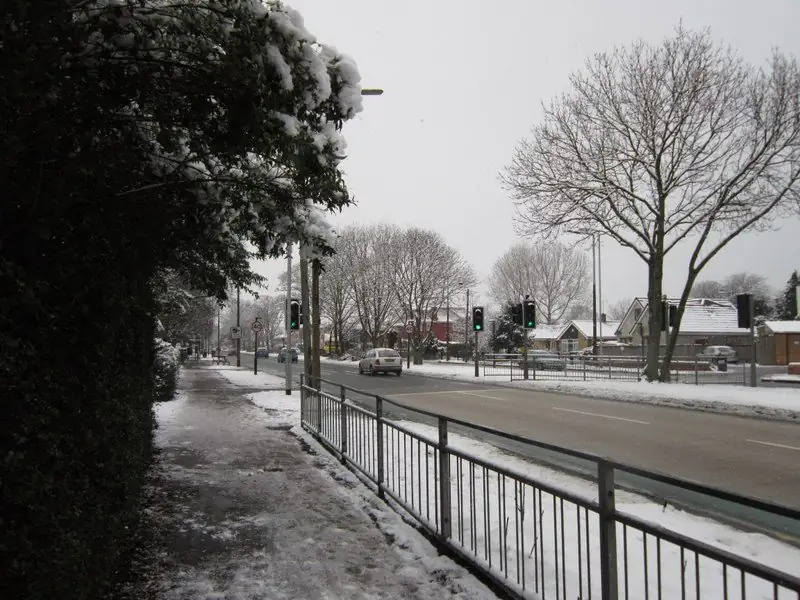
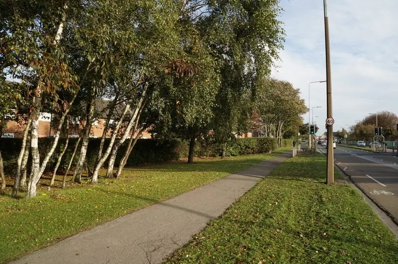
Ian S took both photographs of Holderness Road. They are credited under the figures. They show a main road: frontages close to a busy pavement, shops and houses mixed, limited depth between the building and the kerb. That geometry is the driveway problem. Many properties have no room for a car to sit off the highway without losing the whole front. Side streets off the road are a different geometry again, with longer gardens. Say which you have. A quote written for a side-street semi will be nonsense for a terrace that opens straight onto Holderness Road.
The page title says East Hull because that is how people search, and because "Holderness" alone is also a rural district name. The place in the heading is East Hull. The map button is aimed at Holderness Road, Hull, so it does not open on the countryside. Press it only when you want the Google frame.
Two conservation areas, and what their Article 4 notes do not say
The council's list includes Holderness Road (east) and Holderness Road (west) as separate numbered areas. A house can be in one, the other, or in neither if it is on a side street outside the boundary. The PDF map is the check.
The Article 4 notes in that download mention Holderness Road in the houses-in-multiple-occupation line, grouped with the Avenues, Pearson Park, Newland, Newland Park and Beverley Road. Read that as an HMO note. The lines that explicitly mention hard-standing areas and cross-overs are attached, in that same download, to the Avenues and Pearson Park and to Spring Bank West, not to a sentence that says "Holderness Road hard standings". Garden Village's 2025 direction is narrower still: its schedule names the Garden Village conservation area. Garden Village has its own page for that reason. Do not borrow it for a shop front on Holderness Road.
If your house is inside one of the two Holderness Road conservation areas, tree notices and demolition controls can still apply. GOV.UK's tree guidance is the general notice duty. This page does not add an invented list of banned doors or roofs.
The drain that shares the name
Hull's flood-strategy appendix is useful here because it names the Holderness Drain as a designated main river that discharges directly into the Humber, running on the east side of the city, parallel in role to the Beverley and Barmston Drain on the west. Sutton Cross Drain and Old Fleet Drain are also named in the east. The road and the drain are not the same object. Living on Holderness Road does not mean the drain is at the bottom of the garden. It does mean the eastern catchment is part of how Hull moves water to the estuary.
A new impermeable frontage that throws rain to the road is a small addition to a system the strategy already treats as significant. Where the garden is only a yard deep, the honest design may be "do not pave it", or a narrow permeable strip that still leaves a path. The planning guide sets out the national five-square-metre test. On a tiny terrace front the area may be under that figure. Measure it. Do not assume a main road terrace is exempt, and do not assume it fails.
The BGS viewer should be used on the side street or the main-road plot you actually own. East Hull's superficial deposits are part of the city's alluvial and tidal story, not the chalk hillside. A base designed for a sandy plot in Cottingham is the wrong import.
Classified-road caution
The June 2025 dropped-kerb pack says planning permission is required if the crossing is on a classified road. Holderness Road is the sort of radial where that test is the first question, not an afterthought. This page does not declare the A-road number or the classification from memory. The pack and the council do. If the road is classified, you are in the planning-permission case, and the pack's turning-space discussion applies. A terrace with a yard of three or four metres will not meet a large turning diagram. That can mean the right outcome is no new crossover.
Even off a side street, the city's approval is required before the kerb is lowered, and only an approved crossing contractor should do that part. The private yard can be priced by a driveway business. The pavement cannot be treated as part of the garden. See the dropped kerbs page.
Parking on an existing crossing is a separate offence the council warns about, because the crossing is still highway. A quote that tells you to "just park across the pavement" is not advice this site will echo.
Side streets worth naming in the form
East Hull side streets include everything from older terraces to later infill. Sutton-on-Hull is the village at the north-eastern end of this side of the city, with Church Street and its own conservation area. Bransholme is the estate north of here. If you searched "east Hull driveway" and you actually live on Wawne Road, use the Bransholme page. If you live in Garden Village, use that page, because the Article 4 position is different.
For a Holderness Road address, write the house number, whether you are on the main road or a side street, whether any crossover exists, and how deep the front is in metres. Depth is the fact that changes the job from "possible" to "do not bother".
No one at Hull Driveways phones you, because the site has no phone line, and this site does not install the drive.
Questions about East Hull
Why is the web address still /areas/holderness/?
The previous site used that path. Keeping it avoids a broken link. The heading says East Hull so the page matches the way the area is searched.
Does the HMO Article 4 stop me paving?
The note this site has read groups Holderness Road with an HMO direction. It is about houses in multiple occupation, not a published hard-standing ban of the Avenues type. If the council has made a further direction, its website outranks this paragraph. Check it.
Is every photograph a driveway?
No. Both are Holderness Road street views by Ian S.
Sources: Conservation area list; Article 4 directions index; Dropped kerb pack, June 2025; Hull dropped kerbs; Flood strategy appendix, Holderness Drain; BGS Geology Viewer.